Back to full schedule.
Educational Sessions
Arboriculture Research and Education Academy (AREA)
Using Airborne Multispectral Imagery for Precision Urban Forest Management
Wednesday, 12 August 2015
2:45 PM — 3:15 PM
Osceola 1, 2, 3
A, M, Bm
Airborne remote sensing technologies have been used widely for forest and woodland management (Evans et al. 2012), however, their use for precision diagnosis, monitoring and management of urban forests is still in its infancy. We will present the findings of applied research conducted over the past five years. These findings include very precise canopy cover maps stratified into different height categories, showing change in canopy cover over a two year period in different land-use categories. Relationships between percentage canopy cover and the Urban Heat Island (UHI) effect will be presented. A novel approach has also been adopted to use this multispectral imagery to monitor the change in condition (health) of individual trees in urban landscapes, including streetscapes, parks, gardens and bushlands. This data has been used to identify trees declining in health, and implement targeted sampling programs to provide early diagnosis and treatment of tree health disorders, including serious diseases (Barber et al. 2013). The data has also been used to monitor the efficacy of implemented management strategies. Examples will be presented. This technology and approach is being adopted by municipalities and government agencies, and shows great promise for the sustainable management of urban tree health and important pests and diseases, including Emerald Ash Borer (EAB).
Presenter Information
-
-
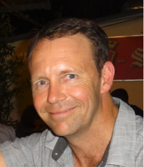
 Paul A Barber
Paul Barber has a PhD in forest pathology and is passionate about the accurate diagnosis, monitoring and management of urban forests. Paul is the Director of ArborCarbon, an arboricultural and environmental consulting firm working throughout Australia and Asia, and Adjunct Associate Professor at Murdoch University in Western Australia. Over recent years Paul has also become qualified in tree risk assessment (QTRA and TRAQ). Paul has conducted intensive research and uses remote sensing technologies and novel treatments to precisely diagnose and manage urban tree health disorders.